![]()
![]()
![]()
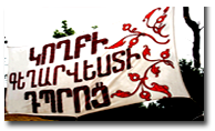
 History
A brief historical-geographical overview

The village of Koghb is located in the north-east of the Republic of Armenia and is the largest village in the Tavush region. Koghb has also been known as Koghbakar, according to the Ashkharatsuyts. Koghb was the administrative center of the Koghbapor province of the Gugark State in Greater Armenia (Pavstos Buzand, Movses Kohrenatsi, Armenian History 387). Koghb was also a provincial area in the Utik State and was an intersection point of roads from Asia Minor, Iran, Georgia, and Assyria in addition to the States of Ayrarat, Gandzak and Aghvank. The province of Koghbapor was located in the governorship of Gugark which was founded to protect the northern gate of Greater Armenia.
Excavations have shown that Koghb was one of the oldest settlements in Armenia. It is a historical monument of the Middle Ages.
Late 19th century bishop and historian Makar Barkhudaryan wrote the following of Koghb: “Koghb has a church named Surb Astvatsatsin, built on six pillars, 22 x 12 m and has two priests. The church has a Gospel manuscript, written by deacon Nasip in village Tag in the Dizag province, in 1563.”
Before 1920, Koghb was a part of the Kazakh province of the Yelizayetpol state. From Soviet times until 1937, Koghb was a part of the Dilijan, Alaverdi, and Ijevan districts. Later, following the establishment of the Tavush region, it has remained a part of the Noyemberyan district.
To the south-west of Koghb lies the Gugarats Mountain at an elevation of 800m which is divided with a ridge, Kozman. Koghb has a moderate climate. The average annual temperature is 13 degrees and the average rainfall is between 600-700mm. Winter and summer are moderate, spring is short and rainy, and autumn is long and mild.
The village is located in an active seismic zone, as it has been since medieval times. According to Kirakos Gandzaketsi, Mshkavank was ruined and four priests died during an earthquake in 1188. There have been more modern earthquakes in 1988 and 1997.
The river Koghb flows through the village. Ghamshutala and Kozman contain mineral water reserves. There is a large forest, san, zeolite, clay, gypsum, and limestone in the area. Old iron mines have been identified (Bover). The earth here is gray-brown and the relief is ribbed.
↑ top
Next Page:Historical Places and Monuments
Previous Page:


.jpg "Karapet Ghulijanyan (8).jpg")
